

Key Highlights
- Location: South Asia, between China (Tibet) and India. Landlocked.
- Area: About 147,181 km²
- Size: About 800–885 km east to west, and 150–250 km north to south
- Elevation range: From about 60 m to 8,848.86 m, the greatest range of any country
- Three regions: Terai (plains), Hills (middle hills and valleys) and Himalaya (mountains)
- Mountains: 8 of the world's 14 peaks over 8,000 m, including Everest
- Rivers: Four main river systems (Koshi, Gandaki, Karnali and Mahakali) and about 6,000 rivers and streams
- Best time to see the landscape: Autumn (September–November) and spring (March–May)
Nepal's geographical location and landscape make it one of the most remarkable countries on Earth. Nepal is a small, landlocked country in South Asia, wedged between China to the north and India to the south, east and west. Within a strip of land only about 150–250 km wide, the ground rises from subtropical plains at around 60 m above sea level to the summit of Mount Everest at 8,848.86 m. No other country packs such a height range into so little distance.
That dramatic rise creates three main landscapes: the flat, fertile Terai in the south, the green middle hills and valleys in the centre, and the snow-covered Himalaya in the north. In a single trip you can track rhinos through tropical grassland, explore the temples of Kathmandu, and trek beneath the world's highest peaks.
This guide explains where Nepal is, how its landscape formed, and how its geography shapes its climate, wildlife, culture and travel.
Where Is Nepal Located?
Nepal's Location in South Asia
Nepal lies along the southern slopes of the central Himalaya, between the Tibetan Plateau to the north and the Indo-Gangetic Plain to the south. It is completely landlocked, and the nearest coastline is the Bay of Bengal, roughly 1,000 km away through India. That is why nearly all of Nepal's trade passes through its two neighbours.
Nepal's Geographic Coordinates
Nepal lies roughly between 26°22′N and 30°27′N latitude and 80°04′E and 88°12′E longitude. Kathmandu, the capital, sits at about 27.7°N, 85.3°E, at an altitude of around 1,400 m.
Nepal's Borders and Neighbouring Countries
Direction | Neighbour |
North | China (Tibet Autonomous Region) |
South | India |
East | India (Sikkim and West Bengal) |
West | India (Uttarakhand) |
Sitting between two Asian giants has shaped Nepal's history and culture. Historic trade routes linked India and Tibet through the Kathmandu Valley, bringing together Hindu and Buddhist traditions that still blend today. The Himalaya protected Nepal to the north, and the country was never colonised. Today its position shapes trade, transport and tourism: most visitors arrive by air at Kathmandu, and overland travellers cross the open border from India.
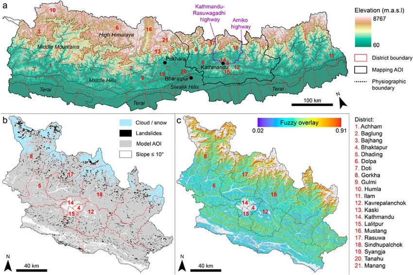 Nepal's geographical location
 How Large Is Nepal?
Nepal covers about 147,181 km², roughly the size of England and Wales combined. (Some official sources give 147,516 km², which includes disputed territory in the far west.) It stretches about 800–885 km from east to west but only 150–250 km from north to south.
That narrow width is the key to Nepal's landscape. Travelling north across Nepal, the land climbs about 8,800 m in under 250 km. You pass through tropical, temperate, alpine and arctic-like zones in the space of a day's drive plus a few days' walk.
How Nepal's Landscape Was Formed
Nepal's mountains are among the youngest on Earth, and they are still growing. Around 50 million years ago, the Indian tectonic plate began colliding with the Eurasian plate. The collision crumpled and pushed up the land to form the Himalaya, and India is still pushing north today. As a result, the mountains continue to rise by a few millimetres each year.
The same forces make Nepal earthquake-prone, as the 2015 Gorkha earthquake showed. Fast-flowing rivers have cut deep gorges through the rising land. Among them is the Kali Gandaki gorge, which runs between Dhaulagiri and Annapurna and is often described as one of the deepest in the world.
Nepal's Three Major Geographical Regions
Nepal's land is often divided into three east–west belts. Geographers sometimes split these further into five zones: the Terai, the Siwalik (Chure) hills, the Mahabharat range and middle hills, the high Himalaya, and the trans-Himalaya.
1. Terai Region (about 17% of Nepal)
The Terai is Nepal's southern lowland, a flat, fertile strip usually below 300 m. It is hot and subtropical, with rich farmland that has earned it the name "granary of Nepal", along with dense sal forests and wetlands. Much of Nepal's population and farming is concentrated here.
The Terai is also home to Chitwan and Bardiya National Parks, famous for one-horned rhinos and Bengal tigers. It includes Lumbini, the birthplace of the Buddha.
2. Hill Region (about 68% of Nepal)
The Hill region, or Pahad, is the largest belt. It rises from about 600 m to 3,000 m through the Chure and Mahabharat ranges into green valleys. The landscape is one of terraced fields, forested ridges, river valleys and hilltop villages.
This is where Nepal's major cities and cultural centres lie, including the Kathmandu Valley, Pokhara, Bandipur and Gorkha.
3. Himalayan Region (about 15% of Nepal)
Above about 3,000 m lies the Himalayan region. It is a landscape of snow peaks, glaciers, high valleys and mountain passes, and it is home to Sherpa, Tamang, Gurung and other highland communities.
The main trekking regions are here: Everest, Annapurna, Manaslu, Langtang and Kanchenjunga. North of the main range, in places like Upper Mustang and Dolpo, lies the trans-Himalaya. This is a high, dry, desert-like landscape in the rain shadow of the mountains, geographically much closer to Tibet than to the rest of Nepal.
 Geography of Nepal
Nepal's Mountain Landscape
Mount Everest and the High Himalaya
Mount Everest (8,848.86 m), known in Nepal as Sagarmatha, rises on the Nepal–China border in the Khumbu region. It is surrounded by other giants including Lhotse, Makalu and Cho Oyu, and by huge glaciers like the Khumbu and Ngozumpa.
Nepal holds 8 of the world's 14 peaks above 8,000 m: Everest, Kanchenjunga, Lhotse, Makalu, Cho Oyu, Dhaulagiri, Manaslu and Annapurna I.
Major Himalayan Regions
- Everest (Khumbu): The highest peaks, Sherpa culture and glacial valleys. Reach it on the Everest Base Camp Trek
- Annapurna: The most varied region, running from subtropical valleys to high desert.
- Manaslu: Remote, with a strong Tibetan cultural influence.
- Langtang: The closest major mountain region to Kathmandu.
- Kanchenjunga: Wild and remote, in far eastern Nepal.

Nepal's Hills, Valleys and Terraced Landscapes
The middle hills look completely different from the Himalaya. Here you find rolling green ridges, deep river valleys, terraced rice and millet fields, rhododendron and oak forests, and villages perched on hilltops.
Kathmandu Valley
The Kathmandu Valley is a bowl-shaped valley at about 1,400 m, ringed by forested hills. It was once a lake, and the lakebed left behind fertile soil. The valley contains Kathmandu, Lalitpur (Patan) and Bhaktapur, along with seven UNESCO World Heritage monument zones. Easy day tours and hikes lead to ridges like Nagarkot, which have Himalayan views.
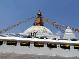
Pokhara Valley
At about 820 m, Pokhara lies beside Phewa Lake, with Machhapuchhre and the Annapurna range rising steeply behind. Within a very short horizontal distance, the land climbs from a subtropical lakeside to peaks above 8,000 m. Pokhara is also the gateway to Annapurna treks and is known for its caves, gorges and paragliding.
Nepal's Rivers and Water Resources
Nepal is sometimes called the "water tower of South Asia". Its roughly 6,000 rivers are fed by glaciers, snowmelt and monsoon rain, and they flow south into the Ganges.
Major River Systems
- Koshi: Eastern Nepal. It is the largest system and includes the Arun, Tamur, Dudh Koshi and Sun Koshi.
- Gandaki (Narayani): Central Nepal. It includes the Kali Gandaki, Trishuli, Marsyangdi and Seti.
- Karnali: Western Nepal. It is Nepal's longest river.
- Mahakali: It forms Nepal's western border with India.
Rivers and the Himalayan Landscape
These rivers carve gorges, irrigate farmland, supply drinking water and power Nepal's hydropower plants. They also shape trekking routes: many trails follow river valleys up into the mountains. The rivers also create world-class white-water rafting on the Trishuli, Seti and Bhote Koshi. Rivers can also be dangerous. Glacial lake outbursts and monsoon floods, including the August 2026 flood in Rasuwa, can damage roads and trails.
Nepal's Elevation and Topography
Zone | Elevation | Landscape |
Lowland Terai | About 60–300 m | Flat plains, forest, farmland |
Middle hills | About 600–3,000 m | Ridges, valleys, terraces |
High Himalaya | About 3,000–8,849 m | Alpine meadows, glaciers, peaks |
Trans-Himalaya | About 3,000–6,000 m | Dry, desert-like valleys |
Above around 4,000 m, the trees give way to alpine meadows. Higher still, above roughly 5,000–5,500 m, there is permanent snow and ice.
Climate and Landscape Diversity in Nepal
Elevation controls Nepal's climate more than latitude does.
- Terai: Hot and subtropical, with summer temperatures that can exceed 40°C.
- Hills: Mild and temperate, with warm summers and cool winters.
- Himalaya: Cold and alpine, with freezing nights and snow at high altitude.
Nepal has four main seasons. Spring (March–May) is warm, with rhododendrons in bloom. Summer/monsoon (June–August) brings most of the year's rain. Autumn (September–November) is clear and dry. Winter (December–February) is cold in the mountains and mild in the lowlands.
Nepal's Forests and Biodiversity
Within just 250 km, Nepal moves from tropical sal forests through subtropical and temperate forests of oak, pine and rhododendron to alpine shrubland and high-altitude tundra. About 23% of the country is protected in national parks and conservation areas.
Wildlife Across Nepal's Landscapes
- Terai: One-horned rhinoceros, Bengal tiger, Asian elephant and gharial crocodile.
- Hills: Red panda, Himalayan black bear and leopard.
- Himalaya: Snow leopard, Himalayan tahr, blue sheep and musk deer, plus the Danphe (Himalayan monal), Nepal's national bird.
How Geography Shapes Life in Nepal
- Agriculture: Rice, wheat and sugarcane grow in the Terai. Maize and millet grow on hillside terraces. Potatoes and barley grow in the mountains, where people also keep yaks.
- Culture: Terai, hill and mountain communities have developed distinct languages, festivals and traditions shaped by their environments.
- Settlement: Most people live in the Terai and the valleys, where land is flatter and more accessible.
- Transport: Steep terrain makes road building difficult, so domestic flights and walking trails remain essential. Many mountain villages can still only be reached on foot.Nepal's Landscape by Region
Region | Main landscape | Climate | Popular activities |
Terai | Plains, forests, wetlands | Hot, subtropical | Wildlife safaris, cultural tours |
Hills | Valleys, ridges, terraces | Mild, temperate | Hiking, sightseeing, culture |
Himalaya | Peaks, glaciers, high valleys | Cold, alpine | Trekking, mountaineering |
Trans-Himalaya | High desert, canyons | Dry, cold | Cultural trekking |
Best Places to Experience Nepal's Landscape
- Everest region: The highest mountains on Earth. For big views without high altitude, try the Everest View Trek.
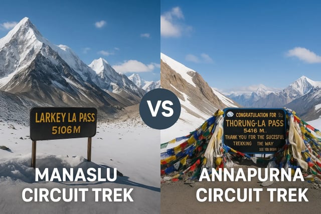
- Annapurna region: It runs from rice terraces to high desert in a single trek. See the Annapurna Circuit Trek k
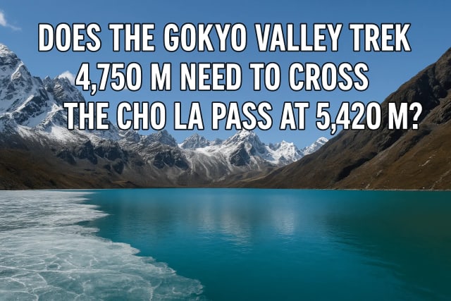
- Gokyo: Turquoise glacial lakes beside Nepal's longest glacier, and an internationally recognised wetland. See the Gokyo Lakes Trek
- Pokhara: Lakes, caves and a mountain backdrop.
- Kathmandu Valley: Historic cities, set in a hill-ringed valley.
- Chitwan: Terai jungle and grassland wildlife. See the Chitwan National Park
- Upper Mustang: Trans-Himalayan canyons and cave dwellings.
- Manaslu: Remote valleys and Tibetan-style villages. See the Manaslu Circuit Trek
- Langtang Valley: Glacial valleys close to Kathmandu. See the Langtang Valley Trek . Check access first following the 2026 floods.
- Rara Lake: Nepal's largest lake, in the remote far west.
 Geography of Nepal
Best Time to Explore Nepal's Landscape
- Spring (March–May): Rhododendron forests bloom and it is good trekking weather.
- Monsoon (June–August): The landscape is at its greenest, but rain, landslides and cloud affect travel. The rain-shadow regions of Mustang and Dolpo remain good options.
- Autumn (September–November): The clearest mountain views of the year. See our guide to the Best Autumn Treks in Nepal .
- Winter (December–February): Crisp views and quieter trails, but it is very cold at altitude.
For more, read our guide to the Best Time To Visit Nepal.
Conclusion
Nepal's geographical location and landscape explain almost everything about the country, from its climate and wildlife to its culture and world-class trekking. Wedged between India and China, Nepal climbs from tropical plains to the roof of the world in less than 250 km, with fertile valleys, deep river gorges, glaciers and the highest mountains on Earth along the way.
Ready to see it for yourself? Explore our treks and tours and let Nature Heaven Treks and Expedition plan your journey through every layer of Nepal's landscape.
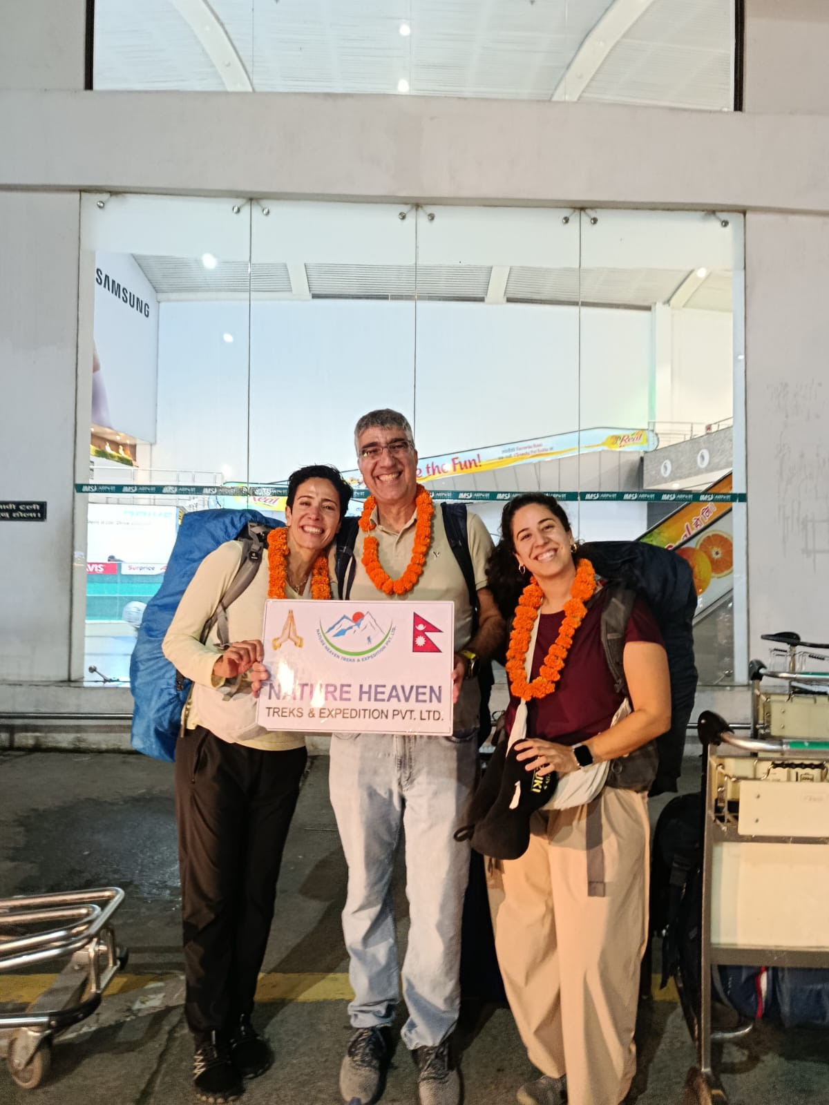 Nature Heaven Trek
Frequently Asked Questions
Where is Nepal located?
Nepal is in South Asia, between China to the north and India to the south, east and west.
Which countries border Nepal?
Two countries: China and India.
What are the three geographical regions of Nepal?
The Terai (plains), the Hills, and the Himalaya (mountains).
What is the landscape of Nepal like?
It runs from flat subtropical plains in the south, through green terraced hills, to snow-capped Himalayan peaks in the north.
Why is Nepal geographically diverse?
Because the land rises nearly 8,800 m in less than 250 km, creating many climate and ecological zones.
What is the highest point in Nepal?
Mount Everest, at 8,848.86 m.
What are the major rivers of Nepal?
The Koshi, Gandaki (Narayani), Karnali and Mahakali.
Does Nepal have mountains, hills and plains?
Yes. All three landforms are found within a short distance of each other.
How does geography affect Nepal's climate?
Elevation controls temperature. The Terai is hot, the hills are mild and the Himalaya is cold.
Why is Nepal famous for its mountains?
Nepal is home to Mount Everest and 8 of the world's 14 highest peaks.
Plan your trek
Want to Plan Your Holiday in Nepal?
Tell us your dates and fitness level. A local expert replies within a day with a private itinerary and price.